European Union grants US request to restrict satellite images of Iran War region
At a glance
The European Union has begun delaying the release of satellite images showing shipping lanes near the Strait of Hormuz by 24 hours. The move comes in response to an earlier US government request and coincides with the Trump administration ramping up the war with Iran once again. The unusual change in the free and open
- Primary source
- Ars Technica - All content — Read original article
- Published
- Topic
- Trump
The European Union has begun delaying the release of satellite images showing shipping lanes near the Strait of Hormuz by 24 hours.
The move comes in response to an earlier US government request and coincides with the Trump administration ramping up the war with Iran once again.
The unusual change in the free and open data policy for Europe’s Copernicus Earth observation program was revealed by Space News , which reviewed a copy of the decision made by the Council of the EU on July 13.
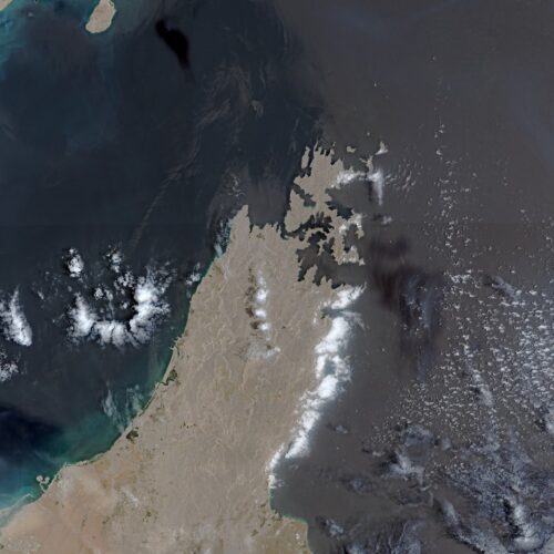
The ordered delay applies to images taken by Sentinel-1 and Sentinel-2 satellites and covers the Gulf of Oman region that includes shipping lanes leading to and from the contested Strait of Hormuz.
The US government first requested that the European Union restrict Copernicus satellite imagery on May 26, according to the decision document seen by Space News.
That request occurred during a shaky ceasefire period for the war that began on April 8 and ended on July 8, when the US military resumed a broader campaign of military strikes following an announcement by President Donald Trump. Read full article Comments
This summary comes from Ars Technica - All content. Read the full article at the original source.
References
More in Trump

Rising Medicare Part D premiums could drive more people into Medicare Advantage plans
Medicare Advantage plans could be the winners of a decision by the Trump administration to put an early end to a program that kept the cost of Medicare prescription drug plans…

Trump blames Tim Walz for water hacks even though it’s probably Iran
Donald Trump speaks during the House Republican Party member retreat. | Image: Mandel NGAN / AFP via Getty Images The FBI, the EPA, and the Cybersecurity and Infrastructure…

Trump beats world champion Wu to reach Shanghai final
World number one Judd Trump aims for his second Shanghai Masters title after beating world champion Wu Yize to reach this year's final.

MAGA is loudly calling for the former White House chief medical adviser to end up in prison. WIRED asked legal experts to weigh in on whether that’s even possible.